Tornado Reported In Jasper County


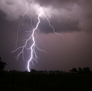
The storms that tore through the area last night did not cause any significant local damage. Dispatchers at the Starke and Pulaski County Sheriff’s Departments received no reports of weather-related problems. A tornado was reported near Rensselaer last night, but no information is available yet about damages or injuries. “The Times of Northwest Indiana” reports it hit near Interstate 65 and Indiana 114 at 8:10 p.m. Several areas to the north and west experienced flooding due to the torrential downpour. More thunderstorms are possible later this afternoon and tomorrow.

Severe Thunderstorms Possible This Evening

LightningParts of the WKVI listening area may be in for severe thunderstorms this evening. The National Weather Service reports a slight risk of severe storms south of U.S. 30. The main threats are large hail and damaging winds, and an isolated tornado may form. Listen to WKVI for the latest on any severe weather that may develop. Should the National Weather Service issue a watch, it just means conditions are favorable for a weather outbreak. A warning means that weather is here, and you should take shelter immediately. If you don’t have a basement, go to an interior room in your house that does not have windows until the storm passes. Check your flashlights and make sure the batteries work, charge your cell phone and keep a battery-operated radio handy just in case. More thunderstorms are possible tomorrow, including an isolated severe thunderstorm tomorrow evening. The threat of severe weather lessens as the week goes on, but rain is in the forecast through early next week.

Flood Warnings Extended for Local Rivers


The National Weather Service has extended flood warnings for two local rivers. Minor Kanakee River flooding is occurring at Davis Route 30. The river was holding steady at 10.4 feet last night. Flood stage there is 10 feet, at which low-lying agricultural areas start to flood. The river is expected to fall below 10 feet Friday morning. The flood warning has also been extended for the Tippecanoe River near Ora. Last night the there was just below the 12-foot flood stage. It’s expected to rise above that tomorrow afternoon, crest near 12.1 feet Wednesday morning and fall below flood stage around mid-afternoon. Significant lowland and rural flooding begins when the river reaches the 12 foot mark.

National Weather Service Issues Tippecanoe River Flood Warnings


Flood warnings have been issued for the Tippecanoe River near Ora and above Winamac until further notice. Recent heavy rainfall has caused minor to moderate flooding, according to the National Weather Service. The Ora warning takes effect this evening. Late this morning the river was at 10.9 feet and rising. Flood stage near Ora is 12 feet. It’s expected to rise above that tonight and crest near 13.5 feet early Tuesday morning. At 14 feet extensive flooding of homes and low-lying areas begins. The Tippecanoe River above Winamac is also on the rise. At noon today it was at 7.9 feet. Flood stage is 10 feet. It’s expected to exceed that very early Sunday morning and crest near 11.1 feet around 8 p.m. Tuesday. At 11 feet extensive residential flooding is in progress. Continue reading

National Weather Service Issues Flood Warning, Wind Advisory


The National Weather Service has extended the flood warning for the Kankakee River at Davis Route 30 until further notice. Last night at 9 the river was at 10 feet there and rising. Flood stage there is 10 feet. The Kankakee is expected to crest at 11.5 feet early tomorrow morning and begin falling. At 11 feet, flooding of secondary roads near the river begins. We’re also in for a blustery day, so hang on to your hats. The National Weather Service has issued a wind advisory, which takes effect at 1 p.m. EDT/noon central and continues through mid-evening. Southwest winds of 25 to 30 miles-per-hour, with gusts to 45 are expected. Isolated gusts of up to 50 miles-per-hour are possible. This will make driving difficult, especially for tall vehicles like vans and SUVs. Large limbs may fall, and isolated power outages are possible.

Kankakee River Expected to Drop Below Flood Stage Today


The flood warning for the Kankakee River at Davis Route 30 continues until tomorrow morning. Minor flooding of low-lying agriculture areas is occurring, but the river was holding steady at 10.1 feet at 8 o’clock last night, according to the National Weather Service. Flood stage is 10 feet. The river is still expected to drop below that level around 7 this morning. More rain is in the extended forecast for Thursday and Friday.

National Weather Service Extends Kankakee River Flood Warning Again


The flood warning for the Kankakee River at Davis Route 30 has now been extended until Wednesday morning by the National Weather Service. Minor flooding is occurring, but the river was holding steady at 10.2 feet this morning. Flood stage is 10 feet. The river is now expected to drop below that level around 7 a.m. tomorrow. More rain is in the extended forecast for Thursday and Friday.

Kankakee River Flood Warning Extended Again


The National Weather Service has once again extended the flood warning for the Kankakee River at Davis Route 30. It is now set to expire Monday evening. Last night at 8 o’clock the river was holding steady at 10.8 feet. Flood stage there is 10 feet, and minor flooding is occurring. The river is expected to fall below the flood stage around 7 p.m. Sunday. At 11 feet, flooding of secondary roads near the river begins.

Spring Brings Potential for Severe Weather


Today is the first day of Spring. Unfortunately the season is known for severe weather events that could be dangerous and potentially deadly. This is Severe Weather Preparedness Week. Dave Tucek with the National Weather Service in Indianapolis says this time of the year, residents should keep an eye on the forecast, but also be aware that severe weather can strike at any time.

Continue reading

Flood Warnings Extended for Kankakeee and Tippecanoe Rivers


Flooding remains a concern this week in two problem spots. The National Weather Service has extended the flood warning for the Kankakee River at Davis Route 30 until late Friday. Minor flooding is already occurring in that area, and additional flooding is forecast. Flood stage there is 10 feet, at which point flooding of low-lying agricultural areas begins. Last night at 9 the river there was at 10.3 feet and holding steady. The Kankakee River at Davis Route 30 is expected to drop below flood stage early Friday morning.

The flood warning for the Tippecanoe River near Ora has also been extended until tomorrow night. As of 10 p.m. Sunday the river there was at 12.2 feet and steady. Flood stage is 12 feet. Minor flooding is occurring, and more minor flooding is forecast. The Tippecanoe River near Ora is expected to fall below flood stage tonight.

If you encounter roads that are covered with water, don’t try to drive through it, as the road surface may be washed out underneath. High water and road closed signs are put in place for your safety.


###

Wind Chill Advisory in Effect Until Mid-Morning


Bundle up if you’re heading out this morning. The entire WKVI listening area is under a wind chill advisory until noon EST/11 a.m. CST today. A combination of falling temperatures and brisk west winds will make it feel like it’s 10 to 20 below zero. Wind chills this low can lead to frostbite of exposed skin in 30 minutes and hypothermia if precautions aren’t taken. Wear a hat and gloves if you do go out. Continue reading

National Weather Service Extends Tippecanoe River Flood Warning


The flood warning for the Tippecanoe River near Ora has been extended through the weekend. Last night at 8 the river was at 14 feet and steady. Flood stage is 12 feet, and moderate flooding will continue through the weekend. The river is now expected to fall below flood stage around 4 p.m. on Saturday. At 14 feet, extensive flooding of residences and low-lying areas begins to occur. This crest compares to last April 21 when the Tippecanoe crested at 14.4 feet near Ora.

National Weather Service Issues Flood Risk Outlook Report


The latest potential flood outlook for counties in northern Indiana and southern lower Michigan has been released by the National Weather Service of Northern Indiana, indicating an increased risk of flooding later this week. Several factors will play a part in the possibly flooding, officials say, as widespread snow and ice contain a large quantity of stored water.

Continue reading

Winter Storm Watch Upgraded to Warning


The Winter Storm Watch for the WKVI listening area has been upgraded to a warning by the National Weather Service. Heavy snow and blowing and drifting are expected this afternoon into tomorrow morning, with total accumulations of between 6 and 10 inches expected by midday Wednesday. North winds will cause considerable blowing and drifting, primarily on east to west roads. This will make travel dangerous. Motorists are advised to only venture out in an emergency. If you must travel, keep an extra flashlight, food and water in your vehicle in case of an emergency. It’s also a good idea to take blankets, a snow shovel, kitty litter to use for traction should you get stuck and enough warm clothes to walk a mile should that be necessary. As always, the WKVI Information Center will be staffed to bring you the very latest on this severe weather.

Wind Chill Warning Set to Expire Later Today


The WKVI listening area remains under a wind chill warning for the next few hours. The National Weather Service advises the warning is set to expire at noon EST, 11 a.m. CST today. Meanwhile, bitterly cold temperatures combined with winds of 10 to 15 miles per hour will cause wind chills between 15 and 25 below zero. Exposed skin can experience frostbite in a matter of minutes when it’s this cold, and hypothermia or even death are possible with prolonged exposure for those not properly dressed for the weather.

Today’s forecast calls for a significant warm up, although temperatures will remain well below freezing. Look for sunny skies and a high of 19 with a wind chill of five above zero. What a difference a year makes. Last year we set a record high of 59 degrees on this date.


Temperatures Continue in the Negative; Wind Chill Warning in Effect


The National Weather Service has issued a wind chill warning for northern Indiana, predicting occasional snow, blowing and drifting snow, and bitterly cold temperatures. However, the Winter Weather Advisory has been allowed to expire for areas outside of lake effect snow showers. Steady or slowly falling temperatures will keep wind chills bitterly cold. A very slow improvement can be expected today and Wednesday.

Continue reading