
The National Weather Service has extended until Saturday the flood warning for the Kanakakee River at U.S. 30. At 10 last night the stage was 10.7 feet and rising. Flood stage is 10 feet. Continue reading


The National Weather Service has extended until Saturday the flood warning for the Kanakakee River at U.S. 30. At 10 last night the stage was 10.7 feet and rising. Flood stage is 10 feet. Continue reading

Northern Indiana is under a Red Flag Warning until 8 p.m. EDT/7 p.m. CDT this evening. That means critical fire weather conditions are either occurring now or will develop shortly. In this case a combination of gusty wind and low relative humidity will cause any fires that develop to spread rapidly. Outdoor burning is not recommended. Be careful when discarding cigarettes and cooking on grills as well.
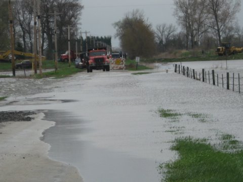
Rapid melting of snow could lead to minor flooding issues as temperatures warm up this week.
Snow melt and frozen ground will prevent the water from being absorbed. The National Weather Service says this combination will result in flooding of low lying areas, ponding on roads, and a rise in water levels in ditches, creeks and retention ponds.
Weather officials believe that river flooding will not be a concern at this time.
Marshall County EMA Director Clyde Avery said that no flood watches or warnings have been issued. He does encourage those who live in flood-prone areas to take precautions to prevent flooding. Never allow children to play near flooded areas. Do not drive around barricades that are blocking roads that are flooded. Road beds may be washed out by flood waters.

A wind chill advisory will take effect this afternoon and remain in place through midday tomorrow. Dangerous wind chill values between 10 and 25 below zero are expected late this afternoon through tomorrow morning. Prolonged exposure to extreme cold can lead to hypothermia and frostbite in 30 minutes or less. If you have to be outside, wear a hat and gloves and protect exposed skin.
A Winter Weather Advisory has been issued for the Kanakee Valley during the overnight hours. It takes effect at 11 p.m. EST/10 p.m. CST and continues through tomorrow evening. Snow and blowing snow are possible, with totals of 3 to 7 inches expected across the advisory area. The system is lake effect, so forecasters stress it’s hard to predict where it will hit. Continue reading
Mother Nature isn’t done with us yet. The National Weather Service has issued a winter weather advisory for the area from noon EST/11 a.m. CST until 7 p.m. EST/6 p.m. CST today. Snow accumulations of between 2 and 4 inches are expected, with locally heavier amounts possible. Visibility may be reduced during periods of heavy snowfall. Motorists should expect snow-covered roads and plan accordingly. Remember, ice and snow, take it slow.
A Winter Storm Warning remains in effect for the WKVI listening area through 7 a.m. EST/6 a.m. CST. A combination of light and blowing and drifting snow will make travel difficult to impossible, and some unplowed roads are likely impassable. Motorists should only travel in an emergency. If you do venture out, be sure to take a flashlight, extra food and water, a shovel, blankets, jumper cables, a cell phone charger and sand or kitty litter to use for traction should you become stuck.
 Marshall County is now under an orange level travel watch. That means only essential travel is recommended. Starke, LaPorte and Pulaski Counties are still under yellow level travel advisories, meaning routine travel may be restricted because roads are hazardous in places. Find more information at http://www.in.gov/dhs/traveladvisory/. Continue reading
Bundle up before you head out, as a wind chill warning is in effect for northern Indiana through Thursday. A combination of very cold air and strong winds will make temperatures feel like they are in the 15 to 30-below-zero range. Frostbite, hypothermia and death are possible if precautions are not taken. Continue reading

Batten down the hatches, we’re in for a blustery day. The National Weather Service has issued a wind advisory for the WKVI listening area until 7 p.m. EST/6 p.m. CST this evening. Southwest winds will increase to 25 to 35 miles-per-hour by mid to late morning, with gusts reaching 45 mph during the day. Continue reading

Freezing rain is possible late tonight into tomorrow morning across much of northwest Indiana. The National Weather Service advises rain will start to fall around midnight and continue through the early morning hours. Continue reading

Strong storms packing high winds are possible across the Kankakee Valley today. Starke County Emergency Management Agency Director Ted Bombagetti says the full oliage on the trees will cause them to act like kites and blow in the wind. As a result, the potential for lost power will be high. Continue reading

We’re in for another hot, humid day across the Kankakee Valley. Temperatures are expected to climb into the upper 80s to around 90 today. It will feel much warmer due to increasing humidity. By this afternoon the heat index is expected to be in the 95 to 100 degree range. Outdoor workers are urged to take frequent breaks and drink plenty of water to stay hydrated. If you have outdoor pets, make sure they have ample water and plenty of shade as well.

Flash flood warnings are in effect this morning for parts of the WKVI listening area. The National Weather Service has issued warnings for Starke, Pulaski, Fulton and LaPorte Counties. Additional rain is expected until about 8 a.m. Central and could cause problems in low-lying areas. Excessive runoff from heavy rainfall may also lead to flooding of small creeks, streams, highways and overpasses. Should water start to rise, move to higher ground immediately.

The National Weather Service confirms two tornadoes touched down in the northeastern part of Starke County last week. Another pair of tornadoes was also confirmed in LaPorte County in the early morning hours of Tuesday, July 1. All four were EF-1, packing wind speeds of between 95 and 105 miles-per-hour. Continue reading

“Tornado activity” was confirmed by the National Weather Service as the cause of extensive damage from Monday night’s storms in the Grovertown area.
Starke County EMA Director Ted Bombagetti told WKVI News that he conducted an assessment in the Grovertown area late Wednesday afternoon and he observed rotational damage in the area. That information was forwarded to National Weather Service officials who confirmed “tornado activity” occurred in the area.
 Starke County Emergency Management Agency officials are still assessing the damage caused by Monday night’s storms. Director Ted Bombagetti is working with the National Weather Service to conduct an initial damage assessment. They’ve confirmed straight-line winds hit several areas but have yet to officially confirm any tornado touchdowns. Continue reading
The National Weather Service has confirmed that two tornadoes touched down in Marshall County just after midnight on Tuesday in a line of storms that caused severe damage and widespread power outages.
Marshall County Emergency Management Agency Director Clyde Avery said the pair of tornadoes touched down in the Plymouth area.
 There’s no evidence a tornado touched down in Starke County Monday night, according to Emergency Management Agency Director Ted Bombagetti. He met yesterday with officials from the National Weather Service after conducting an initial damage assessment. Continue reading

The National Weather Service is warning of potential severe storms through Wednesday evening.
Damaging winds, large hail, heavy rain, flooding, lightning, and tornadoes are possible. The highest threat for severe weather will be late Wednesday morning through the afternoon for northern and central Indiana.


